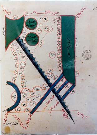
The 10th and 11th centuries were the era of the "Atlas of Islam" - collections of maps which usually included representations of 17 Islamic countries. The Arabs never regarded the Land of Israel, which they called Falastin, as a distinct geographical or political unit, and mapped it as an integral part of ash-Sham, Syria, as in the example shown here. Jerusalem is represented by one of the circles in the upper part of the map (which is directed toward the south-west and is named Bayt al-Maqdas (Hebrew: Bet haMiqdash, the Temple).
 |
Sources: Israeli Foreign Ministry