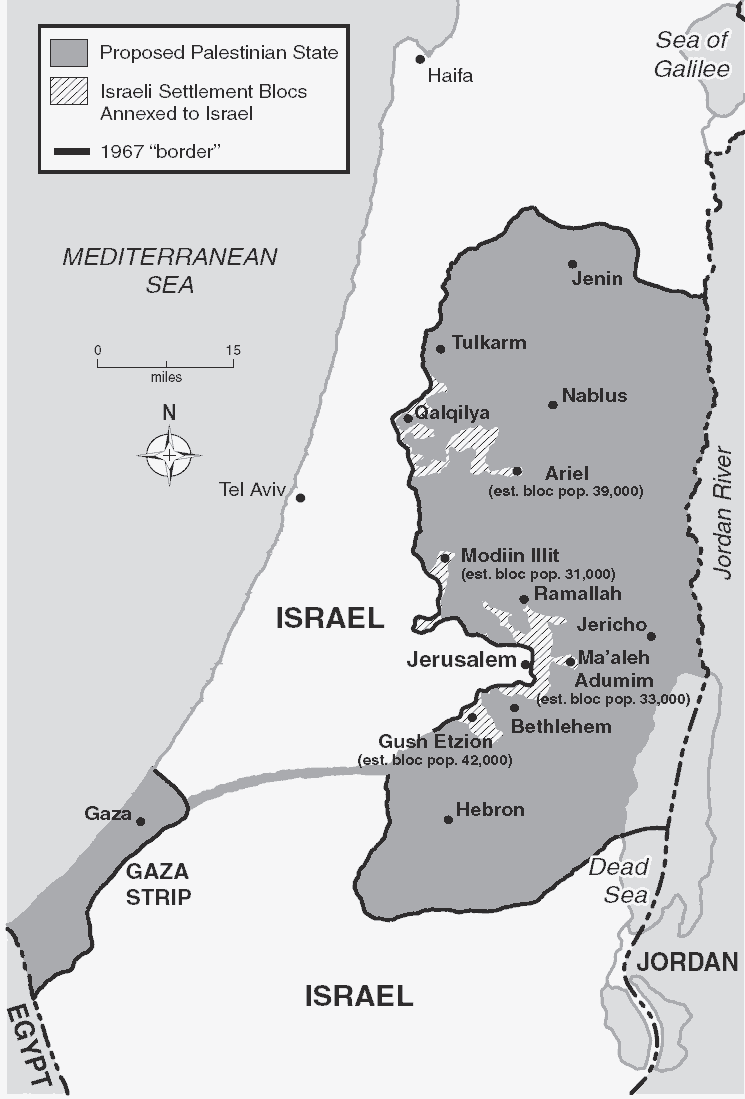
The following map is based on the prospective final settlement of the Israeli-Palestinian dispute discussed at the Camp David 2000 Summit in which Israel’s border would move to the 1967 border with modifications that would take in approximately 70-80% of the Jewish settlers. The new border, roughly along the line the current security fence is being constructed, would run close to the Green Line for most of the border except where it is necessary to enclose the four largest settlement blocs in the West Bank. Even with those bulges, the new border of Israel would require the annexation of only about 5% of the West Bank. The map includes Jerusalem, but does not foreclose the possibility of a compromise whereby a part of the city would be inside the Palestinian state. A variety of ideas have been suggested to connect the Gaza Strip and the West Bank, including an overland highway and a nonstop railway. The route would approximate that in the map, but the size of the connecting area is not drawn to scale.