Geography of Israel: Safed
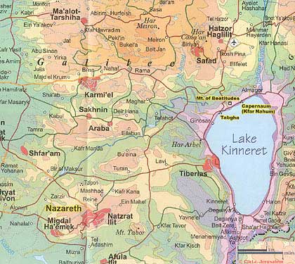
Safed (Heb. צְפָת), also spelled Tzefiya (in the Talmud), Safad, Zefat, Sefad, is the principal town of Upper Galilee, situated on a mountain 2,780 ft. (850 m.) high, 30 mi. (48 km.) east of Acre, 25 mi. (40 km.) north of Tiberias. Not mentioned in the Bible, Safed has sometimes been identified with Sepph (Gr. Σεπφ), the city fortified by Josephus in the Upper Galilee at the time of an expected Roman attack in 66 C.E. (Wars, 2:573); the name is missing in a parallel list (Life, 187–8). In the Jerusalem Talmud (RH 2:1, 58a) Safed is mentioned as one of the mountaintop points from which fire signals were given to announce the New Moon and festivals during the Second Temple period. Two liturgical poems for the Ninth of Av by Eleazar Kallir, Eikhah Yashevah, and Zekhor Eikhah refer to Safed as a place where priestly families (Jakim and Pashhur) settled after the destruction of the Temple. The name is repeated in the various kerovot (hymns recited before the Amidah) by poets who wrote in the sixth, seventh, and eighth centuries.
Between the Talmudic period and the Crusades, the history of Safed is not known. The town reappears in 1140 under the name Saphet, a “fortress of very great strength between Acre and the Sea of Galilee” built by King Fulk of Anjou. Amalric I, the king of Jerusalem, handed it over in 1168 to the Knights Templar. Twenty years later, after his victory at Ḥittin, Saladin took Safed (December 1188). His successors, the Ayyubids, ordered the dismantling of the fortress in 1220; however, in 1240, Safed was recaptured and rebuilt by the Knights Templar. In 1266, it passed from the crusaders to the Mamluk sultan Baybars, who continued to strengthen its fortifications. In Safed, the Mamluks established the headquarters of a “Mamlakah,” a province that extended over Galilee and Lebanon.
Jewish settlement in Safed is attested by genizah documents from the first half of the 11th century. However, Benjamin of Tudela, who visited the city in 1170/71, stated that no Jews lived there. Fifty years later, the settlement was revived under Mamluk protection; R. Zadok, head of an academy of the gaon Jacob, was its most prominent member. Genizah documents confirm that there was a community at Safed in the 13th century; it continued to exist in the time of R. Estori ha-Parḥi (early 14th century).
In 1481, the Jewish community of Safed and the villages in its vicinity numbered 300 families; it flourished under the protection of the Mamluk governors. Toward the end of Mamluk rule, the community was greatly strengthened by an influx of refugees from Spain (1492). In 1495, the Jews of Safed were reported as trading spices, cheese, oil, vegetables, and fruits. The Sephardi element further increased after the Ottoman conquest in 1516.
On February 18, 1577, the Jews petitioned the Ottoman Sultan to protect them against extortion, robberies, and violence. The request states, “The Sanjak-Beg (a local Ottoman official) troubles us at present saying, ‘Most certainly you shall work (on Shabbat).’ He also demands excessive amounts of money. As we are not in a position to pay the money he makes us transport dung on that day (Shabbat).”
In 1522, R. Moses Basola found 300 Jewish families in Safed, composed of Sephardim, Moriscos, and Jews from the Maghreb. Later, three groups emerged among the Jews of Safed: Sephardim, Ashkenazim, and Italians. Among the prominent leaders of the community in the 16th century was R. Jacob (I) Berab, who tried to reestablish the Sanhedrin and renew rabbinical ordination ( semichah). Other prominent rabbis included R. Joseph Caro, the author of the Shulḥan Arukh, and his contemporary R. Moses Trani. The leading kabbalist R. Isaac Luria lived in Safed, and his important disciple R. Chaim Vital resided there for some time. In the 16th century, Safed was the center of Jewish mysticism. The spiritual flowering of the town was accompanied by material prosperity. The newcomers established looms, whose products competed with those of Venice. In addition, the Jews of Safed traded in the local produce of Galilee: oil, honey, silk, and spices. They also received both Jewish and gentile pilgrims in their homes.
Turkish statistics from 1548 show Safed as the center of a district of 282 villages. Approximately 1,900 families of taxpayers lived in the town (716 of them Jewish), as well as 251 single taxpayers (only 56 of them Jewish). In 1563, the brothers Ashkenazi set up the first printing press in the town (see below); it was not only the first one in Ereẓ Israel but also the first in the Orient. The Jews of Safed had eight synagogues; they numbered their town among the Four Sacred Cities of the Holy Land, calling it also Beth-El. In addition to the Jewish community, Samaritans also lived there during the 16th century.
With the gradual decline in the quality of Turkish rule in the 17th century, the prosperity of the Jewish community also began to drop off. The material decline did not immediately influence the spiritual level of the community. In spite of high taxes and 1,200 poor living on charity, there were 300 rabbinical scholars, 18 schools, 21 synagogues, and a large yeshivah with 100 pupils, and 20 teachers at the beginning of the 17th century. The Jewish community at that time split into four congregations: Ashkenazim, Portuguese Jews, Provençal Jews, and Italians. Toward the end of the 17th century, the community declined rapidly – in 1695/96, only 20 Jews paid the poll tax. An epidemic decimated the community in 1747, and an earthquake in 1759 killed 2,000, among them 190 Jews. After the disaster, the survivors began to leave the town; by 1764, there were only 50 Sephardi families in Safed.
Toward the end of the 18th century, the establishment of a more stable government in Galilee (first by the sheik Dhāhir al Omar and then by Jazzr Pasha) led to an improvement in the position of the community. Moreover, immigration was renewed, with settlers coming from East European countries. In 1778, over 300 Ḥasidim, disciples of R. Israel b. Eliezer Ba’al Shem Tov settled in Safed; they were led by R. Menahem Mendel of Vitebsk. The disciples of Elijah, the Gaon of Vilna, who were opponents of the Ḥasidim, came in 1810, led by R. Israel b. Samuel of Shklov. Renewed warfare between the Bedouins, and epidemics in 1812–14, caused an exodus of Jews, mainly to Jerusalem and the villages in Galilee.
[Michael Avi-Yonah]
Modern Period
Under the benevolent rule of Ibrahim Pasha (1831–40), the town at first progressed and became Galilee’s commercial center, but toward the end of his rule, it suffered from the strife between Arabs and Druzes and the Arab revolt against Ibrahim Pasha. It was particularly stricken by a violent earthquake (1837), which destroyed most of its houses and reportedly caused the death of 5,000 persons, 4,000 of whom were Jews. Many of the surviving rabbinical scholars went to Hebron. The Hebrew printing press of Israel Bak, which had been founded in 1831, was transferred after the earthquake to Kefar Jarmaq (Mount Meron) and later to Jerusalem (see below). The Jewish community, which in 1839 had dwindled to 1,500 persons, further decreased to a mere 400 in 1845. However, the country’s administration stabilized under the Turkish sultan ʿAbdul Majīd, and Safed’s situation improved. The former Jewish inhabitants returned, and new immigrants settled, bringing the Jewish community to 2,100 persons in 1856, and to 6,620 in 1895 (comprising 4,500 Ashkenazim and 2,120 Sephardim), who then constituted the majority of a total population of 12,820. The Jewish community increased further to 8,000 persons in 1908, and to 11,000 (out of a total population of 25,000) in 1913.
At the end of the 19th century, Rabbi M. Taubenhaus founded a weaving shop at Safed to provide employment for Jewish workers and opened a soup kitchen for the poor. The first Jewish kindergarten was opened on his initiative in 1906 with the support of B’nai B’rith; in 1910, it was enlarged to become a modern elementary school. The initiative for the changeover to productive work in this community influenced groups of Jews from Safed to attempt agricultural settlement at Gei Oni (later Rosh Pina) and at Benei Yehudah on the Golan. Workshops, mostly for local consumption (e.g., bakeries), were opened in the Jewish quarter, but the majority of the community remained dependent on ḥalukkah from abroad. In World War I, the Safed community was cut off from its sources of support in Europe, and its Jewish population was decimated by hunger and disease. The city’s Arab population, whose economy was based on trade, commerce, and auxiliary farming, was less affected.
On Sept. 28, 1918, the town was occupied by the British forces under Allenby. In 1922, Safed’s population of 8,760 was composed of 5,431 Muslims, 2,986 Jews, and 343 Christians. While good relations between Arabs and Jews had previously been the rule, the Arab population, instigated by the nationalists, assaulted the Jewish quarter in the 1929 riots and killed several of the inhabitants.
By 1935, the number of Jews decreased to 2,475, and their percentage in the total population fell to 27%. It shrank further in the 1930s and 1940s when local educational and economic opportunities for the community’s youth were limited. In Israel’s War of Independence (1948), less than 2,000 of the 12,000 inhabitants were Jews, living in the narrow quarter on the northern and northwestern slope of Safed Hill.
On the eve of the British withdrawal from Safed on April 15, the Palmach infiltrated the town, bolstering the defenses of the besieged Jewish quarter. When the British evacuated the town, they permitted Arab forces (estimated at 4,000–4,500 men, including detachments of the Iraqi and Lebanese armies) to occupy the two large police buildings in key positions, thereby sealing off the Jewish quarter.
On April 30, 1948, Operation “Yiftach” was launched to capture the town. On May 1, 1948, a Palmach force advanced from positions on Mount Canaan and Biriyyah, occupied the Arab villages of Biriyyah and Ein Zeitun, and from there entered the Jewish quarter by hidden paths, bringing the number of its defenders from about 60 to 222. On May 10–11, 1948, the defenders launched attacks on the Arab positions and captured them as well as the Meẓudah (“fortress”) on top of Safed Hill. The entire Arab population and armed forces fled. Safed became a Jewish town.
After 1948, mainly new immigrants from different countries settled in Safed. Its population numbered 7,900 in 1953 and 13,100 in 1970. The town’s economy was based principally on branches of tourism, recreation, and industry. Some of the hotels operated mainly in the summer months. The dry mountain air in summer is noted for its curative quality for respiratory ailments. The hotels were situated both in the town proper and on Mt. Canaan (3,000 ft., 920m., above sea level). A regional hospital with 500 beds was built in 1970. Industry included metal factories (for sewing machines), textile weaving and apparel, food products (notably instant coffee), tobacco, and diamond polishing.
By 2019, the population of Safed had grown to more than 36,000, occupying an area of 15 sq. mi. (40 sq. km.). Residents were employed in industry, services, and commerce. The picturesque artists’ quarter, where scores of painters and sculptors live permanently or seasonally, continued to constitute a tourist attraction. In addition to the individual artists’ galleries, there was a communal exhibit in the quarter. There were also Bible and Kabbalah museums and a flourishing ba’alei teshuvah community, as well as thousands of Russian and Ethiopian immigrants.
Every summer, the city hosts a klezmer festival, and pilgrims flock to the graves of Jewish saints on the outskirts of the city, the most famous being the grave of Rabbi Shimon Bar Yochai, where tens of thousands congregate on Lag b’Omer.
[Efraim Orni / Shaked Gilboa (2nd ed.)
Historic Buildings and Archaeological Restorations
Safed still contains six old synagogues, including the famous Ari synagogue (of R. Isaac Luria) dating from the 16th century, which belongs to the Sephardi community and consists of two vaulted rooms with a courtyard. Another synagogue of Luria belongs to the Ashkenazim and was renewed after the earthquake of 1837. Other famous synagogues are named after R. Yose ha-Bannai, R. Joseph Caro, and R. Yitzhak Abuhav.
Muslim rule in Safed has left numerous monuments, mostly of the Mamluks. These include the so-called Zāwiyat Banāt Hamīd (built in 1372 with additions in 1449); the Red Mosque (el-Jamiʾ el-Aḥmar; built in 1275–76); the Jamiʾ el-Jukandār (named after a Mamluk ruler of 1309–11, though the building actually is from a later date); the “Cave of the Daughters of Jacob” (Magharat Banī Yaʿqūb) and its adjoining mosque (both repaired in 1412); and the Main Mosque (Jami’ as-Sūq) of 1901 and another of 1913. Excavations were started under Israeli auspices in the citadel by M. Dothan in 1950 on behalf of the Department of Antiquities. Crusader and Mamluk walls and foundations were uncovered (most of the walls visible above the surface had been dismantled by the Arabs), as were a complicated system of wells and channels underground.
[Michael Avi-Yonah]
Hebrew Printing
In 1573, the well-known Hebrew printer Eliezer b. Isaac Ashkenazi and his son, Isaac of Prague, left Lublin for Ereẓ Israel, taking with them their printing tools, type, and decorations. After three years in Constantinople, where they printed some books, they proceeded to Safed. There they set up as printers in partnership with Abraham b. Isaac Ashkenazi, a resident of Safed who provided the funds necessary for the enterprise. Between 1577 and 1580, they issued three books. Then Abraham left for Yemen as an emissary of the Tiberias yeshivah, selling his books at the same time. In 1587 Eliezer printed three more books; like the first three, they were all by Safed authors.
In 1832, the printer Israel Bak of Berdichev settled in Safed and issued four books up to 1834, the year the community was pillaged by Arab villagers. In 1836, printing was resumed with the publication of Pe’at ha-Shulḥan by Israel of Shklov. As a result of the earthquake of 1837, Bak went on to Jerusalem. Between 1863 and 1866, Dober b. Samuel Kara, of Skole (Galicia), printed some eight books in Safed. Ten years later, Abraham Ẓevi Spiegelmann and his partners began printing, but only three works are known to have appeared up to 1885. In 1913, Barukh Barzel and his partners opened a Hebrew press called “Defus ha-Galil,” with some 20 books being printed up to 1926. This press served Hebrew writers who found refuge in Safed during World War I. Later, A. Friedmann took over the press, which printed the Haganah paper Kol Ẓefat during the War of Independence.
[Avraham Yaari]
BIBLIOGRAPHY
Avi-Yonah, Geog; Neubauer, Géogr, 227; Conder-Kitchener, 1 (1881), 248ff., 255–6; S. Klein, Beitraege zur Geographie und Geschichte Galilaeas (1909), 58; V. Guérin, Description géographique…, 2 pt. 3 (1880), 419, 426; J. Braslavski, Le-Ḥeker Arẓenu (1954), index; idem, in: BJPES, 9 (1941–42), 55–56; Abel, in: RB, 40 (1931), 602; Israel, Misrad ha-Ḥinnukh ve-ha-Tarbut, Alon Maḥleket ha-Attikot, 3 (1951), 13; I. Ben-Zvi and M. Benayahu (eds.), Sefer Ẓefat, 2 vols. (= Sefunot, vols. 6–7, 1962–63), incl. bibl.; M. Ish-Shalom, Masei Noẓerim le-Ereẓ Yisrael (1965), index; E. Rey, Les Colonies franques de Syrie… (1883), 445; I. Ben-Zvi, Sefer ha-Shomronim (1935), 76; idem, Ereẓ Yisrael ve-Yishuvah (19672), index; S. Schechter, Studies in Judaism, 2 (1908), 202–306; M. Benayahu, in: Sefer Assaf (1953), 109–25; idem, in: Sefer ha-Yovel le-Yiẓḥak Baer (1960), 248–69; idem, in: Sinai, 43 (1958), 35–113; J. Kena’ani, in: Zion, 6 (1934), 172–217; J. Katz, ibid., 16 (1951), 28–45 (second pagination); B. Lewis, Notes and Documents from the Turkish Archives (1952), index; idem, in: Yerushalayim, 4 (1953), 134–7; U. Heyd, ibid., 5 (1955), 128–35; idem, Ottoman Documents on Palestine (1960), index; idem, in: Press Festschrift (1954), 184; B. Lewis, ibid., 134–5; Sefer ha-Yishuv, 1 (1939), 142; 2 (1944), 54; D. Tamar, in: Divrei ha-Congress ha-Olami ha-Revi’i le-Madda’ei ha-Yahadut, 2 (1968), 181–7 (Heb. sec.); idem, in: Y. Raphael (ed.), Rabbi Yosef Caro (1969), 7–18; J. Pinkerfeld, Battei Kenesiyyot be-Ereẓ Yisrael (1946), 38–44, pts. 21–24; idem, L.A. Mayer, and J.W. Hirschberg (eds.), Some Principal Muslim Religious Buildings in Israel (1950), 41–48; A.M. Habermann, Toledot ha-Defus ha-Ivri bi-Ẓefat (1962); Yaari, Sheluḥei, index; idem, Ha-Defus ha-Ivri be-Arẓot ha-Mizraḥ, 1 (1936), 9–28; idem, in: KS, 24 (1947/48), 66. ADD. BIBLIOGRAPHY: Y. Tsafrir, L. Di Segni, and J. Green, Tabula Imperii Romani. Iudaea – Palaestina. Maps and Gazetteer. (1994), 226–27, S.V. “Sepphoris.”
Sources: Encyclopaedia Judaica. © 2007 The Gale Group. All Rights Reserved.
Uriel Heyd, Ottoman Documents on Palestine 1552-1615: A Study of the Firman according to the Muhimme Defteri, (London: Oxford University Press, 1960), p. 166-167.
“Jews in Safed Petition for Protection,” Center for Israel Education.
WEBSITE: www.sefad.co.il.
Download our mobile app for on-the-go access to the Jewish Virtual Library