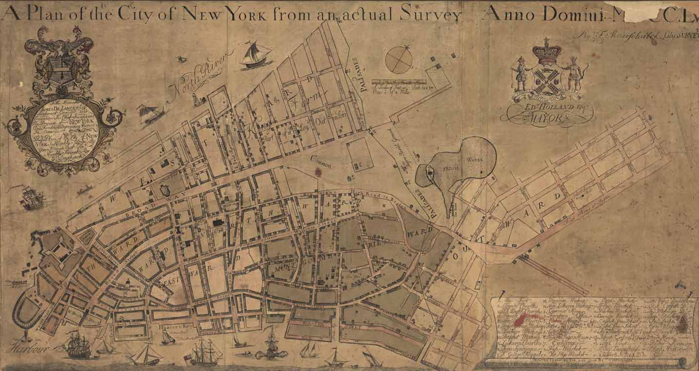
This early map of New
York reflects the
extraordinary diversity of the city in the
eighteenth century and its hospitality to
newcomers. The map provides locations for
the houses of worship of Quakers, Lutherans,
Catholics, Moravians, Presbyterians, Baptists,
and Jews. Marked on this map is the Mill
Street location of America's first synagogue,
Shearith Israel (The Remnant of Israel).
Though the congregation continues to this
day, neither the original synagogue building
nor the street on which it was located has
survived.
Click
on map to enlarge
Francis
Maerschalck (d. 1776).
A Plan of
the City of New York from an Actual Survey,
anno Domini M{D}CCLV .
New York: G. Duyckink, 1755.
Engraved map.
Geography
and Map Division