Operation Protective Edge: Map of Tunnels Under Gaza
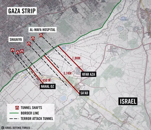
This is a map documenting the tunnels found by the Israel Defense Forces during Operation Protective Edge. They are approximately three miles long and reach deep into Israeli territory. It is believed that they were to be used by Hamas for extensive kidnap operations against Israeli soldiers or civilians.
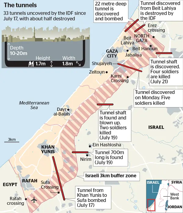
This following graphic gives specific details about the terror tunnels being dug by Hamas, including technical details about height and average depth, as well as dates and markers when and where the specific tunnel was discovered.
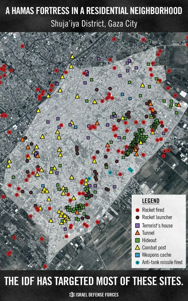
The following graphic shows what the IDF has identified as a Hamas fortress in the residential neighborhood of Shuja'iya in Gaza. The red circles indicate where a rocket has been fired from, the black and red circles indicate current rocket launchers at the time of the photograph. Purple squares represent the homes of known Hamas terrorist militants, the triangles are tunnels and combat posts, green squares are hideouts, blue squares are weapons caches, and blue circles are where anti-tank missiles have been fired from. As is shown by this image Hamas has taken a stranglehold of this entire neighborhood and used it for it's own devices, depriving the citizens of freedom, peace, and safety.;
Sources: Israel Defense Forces, PBS
Download our mobile app for on-the-go access to the Jewish Virtual Library