Bookstore Glossary Library Links News Publications Timeline Virtual Israel Experience
Anti-Semitism Biography History Holocaust Israel Israel Education Myths & Facts Politics Religion Travel US & Israel Vital Stats Women
donate subscribe Contact About Home

Maps of the Palestinian Territories: Aerial Photographs of Jenin (2002)

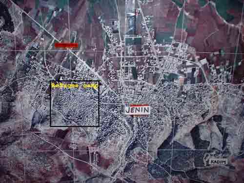
The city of Jenin, including the Jenin refugee camp, prior to Operation 
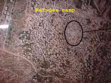
Defensive Shield [first image]. Enlargement of Jenin refugee camp 
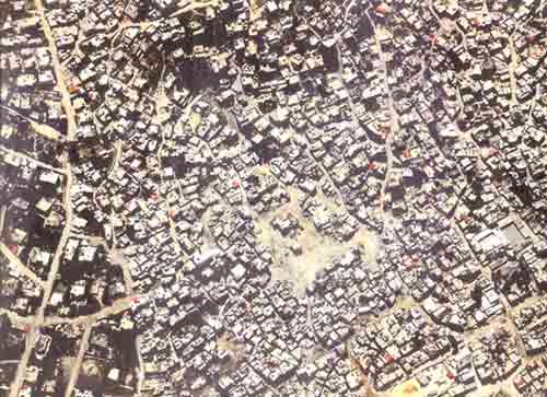
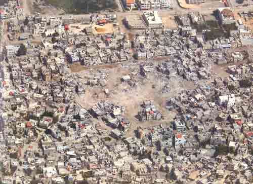
and combat zone on April 13, 2002, after the battle [second image]. Additional aerial views of combat zone in Jenin refugee camp [third & fourth images].

Sources: Israeli Foreign Ministry, IDF Photos