The First Printed Maps of
Lucas Brandis
(1475)
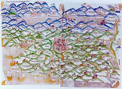
In 1475, Lucas Brandis published an encyclopaedic work about Christianity to which he added two maps which became the first printed maps (all previous maps having been manuscripts). One is a circular world map centered on the Holy Land. The other, shown here, is a map of the Land of Israel with Jerusalem at its center. In common with most mediaeval maps it describes the Bible lands not geographically but symbolically.
Sources: Israeli
Foreign Ministry
|